Tell us about the site
Share the location and what you want the map, model or Explorer to do.
HIGHFRAME / AERIAL MAPPING & 3D MODELLING
Drone scanning for land, property and outdoor spaces. Detailed overhead maps and 3D models for site records, presentation and online exploration.
AT A GLANCE
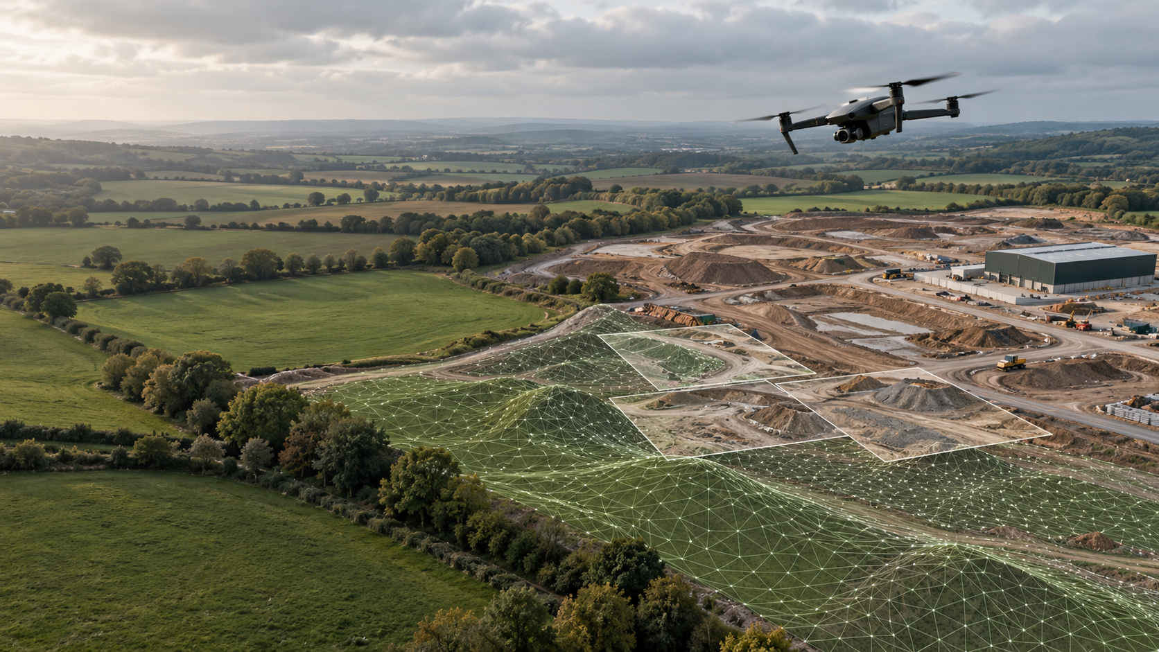
We scan terrain and buildings from above with our drones, then use photogrammetry to recreate them as detailed overhead maps and realistic 3D models. Present a property, record a site or track changes over time. Our own Highframe Explorer lets people move around the captured place and discover its detail online.
THE HIGHFRAME VIEWER
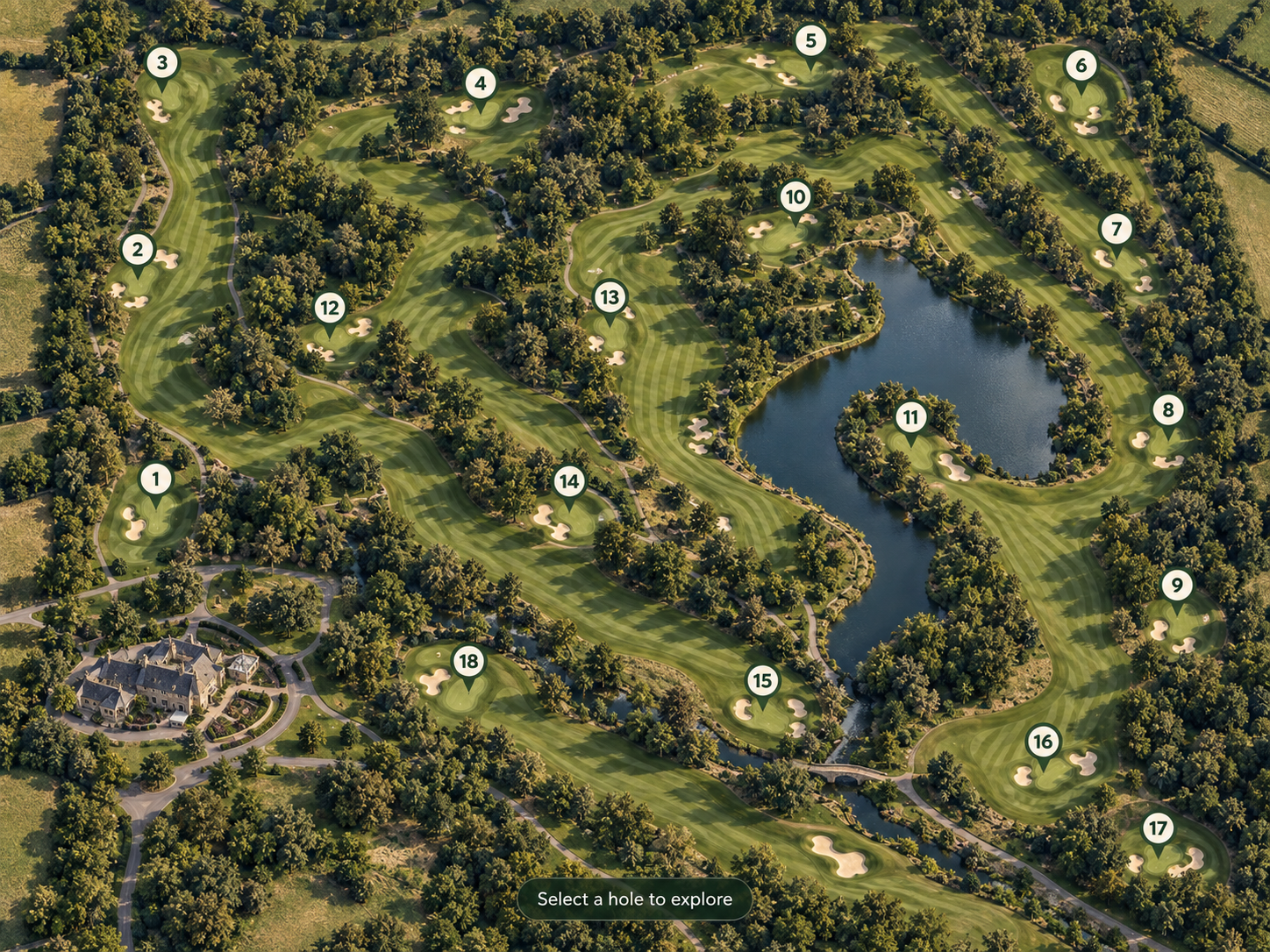
Our own Highframe Viewer turns your 3D scan into an online Explorer. We capture your land, property or outdoor space with our drones, build a detailed 3D model, and bring it online in our own software. Visitors can move around, zoom into the detail and discover key places before they arrive. Share it with a link or embed it on your website.
Share the location and what you want the map, model or Explorer to do.
Agree coverage, access, detail and the outputs you need.
Capture the terrain and buildings, then create your map and 3D model.
Get your files or an online Highframe Explorer, ready to share.
YOUR PLACE, ONLINE
Give buyers a feel for the land, help a team revisit a captured site or show visitors around an outdoor destination. The Highframe Explorer turns your 3D model into a shareable online experience, built around the places and points of interest you want to highlight.
SIMPLE WAYS TO PUT IT TO WORK
One capture can help you show a place, record it or follow how it changes.
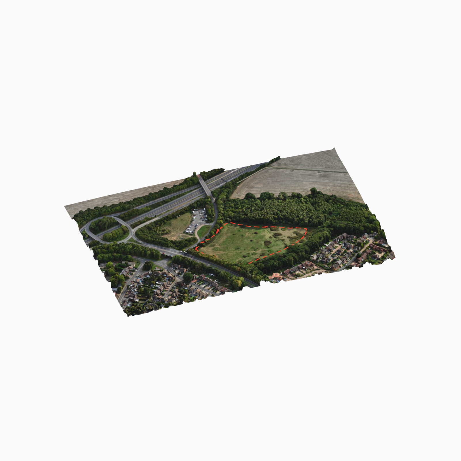
Show the plot, buildings, access and surroundings so buyers can understand the whole setting.
Create an online Explorer for a golf course, outdoor centre, estate or visitor attraction.
Keep dated maps and 3D captures to review changes and share updates with your team.
Document visible building surfaces and site features before works, after works or for later review.
WHAT YOU RECEIVE
A realistic digital version of the visible terrain and buildings, ready to rotate and zoom into.
A clear, continuous view from above—also called an orthomosaic—showing the captured site in detail.
Present your model in our own Highframe software, ready to share as a link or embed on your website.
PLANNED FOR YOUR PROJECT
We agree coverage, detail and delivery around how you will use the capture. If you need measurements or survey support, we also agree the required accuracy and checks before the visit.
DISCUSS YOUR NEXT CAPTURE
Send the site location, the area you need captured and how your team will use the results. We’ll shape the capture and delivery around your project.
Discuss your mapping projectHAVE A PROJECT IN MIND?